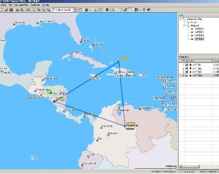
In the last post we have been talking about data downloaded from Magellan devices, and there arises the need for clarification on various MobileMapper Office versions.
The MobileMapper 6 Office
This is software that comes when it’s bought a MobileMapper 6,it is a new software, which just goes by the 1.01.01 version

The utility that this has is that it can both be installed on desktop, or in the same GPS’ Windows Mobile operating system. With this it can be done directly post-processing on the device, in the field.
A disadvantage that we have seen is that it doesn’t have export option, the manual says it is but there isn’t any button which allows operating with data except with shape files which can be post-processed, keeping them in their original location. It is expected that these capabilities will be added in newer versions.
Projects in this have the .map extension, and are a simple external reference file, because like a .mmx or a .prj, display data in different routes.
This software can be downloaded from the Ashtech’s ftp at this link
The Mobile Mapper Office
This is the traditional version, it is PC software, which came since GM Pro versions and that, with the Promark3, come in its 3.4a version. It is compatible with equipments like Mobile Mapper Pro 6.52 6.56 and 7 x.

The advantages of this are in their ability to work with data in AutoCAD / Microstation (dxf), also using data from Mapinfo (mif), ESRI (shp) and Excel (csv) or waypoints (mmw). This can be done to import or export.
The disadvantage is there, while the MM6 works directly on the shape files, in their respective addresses, the MMO import them; to export it again when post processed. It is likely that these features already exist in new MM6 Office versions because that has a more robust and recent development.

It is also possible with this to create background maps that include vector data (dxf, shp, mif) and also raster, including .ecw and .tiff. These background maps can be sent to the GPS from the program, or copied to the SD memory.
Projects in this have an .mmj (mobile mapper office Job file), and unlike the first, retain all within created data. Is has an editor of lists of entities with which you can edit tabular data related to imported files, and it can also be stored with a .mmf extension.
This can be downloaded from the Ashtech’s page at this link
With this I hope the difference has been clarified.
 Autocad Software, Bentley Microstation, Gis Google Earth, Gis System Geomate Provides Services For Complete Gis Software And Solutions, Autocad Software, Autocad Courses, Bentley Microstation, Microstation Software, Gis Google Earth, Open Source Gis And More.