Find maps in vector format of a given country could be the urgency of many. Reading Gabriel Ortiz forum I found this link which is interesting because it not only provides maps in .shp format but in kml, grid and mdb.
It’s gData, a service promoted by the International Rice Research Institute, is free and seems to have information from all over the world.
Maps can be searched by country,
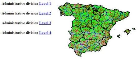
This is an example, in the case of Spain, if we want to find maps of administrative division in kml format the output is:
- Country-level map
- First division (State government)
- Second division (provinces)
- Third division (Counties)
- Fourth Division (Municipalities)

It’s so simple, we just have to download. Although for .shp is not required to download them separately but rather in the compressed file are included files .dbf and .shx; and in case of geodatabase the .mdb contains feature classes.
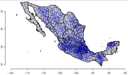
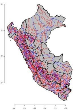
This is the example of Mexico and Peru, to give two examples:

The available data include:
 Vector format:
Shape files. Kmz (For Google Earth) and .mdb as geodatabase
- Administrative divisions (Administrative boundaries)
- Hydrology (Inland water)
- Roads (Roads)
- Railroads (Railroad)
Raster Format:
Grid with a resolution of 30 seconds
- Elevation, SRTM30 dataset
- Vegetation cover
- Population density
- Monthly Climate Data
You will have to verify the accuracy level of your country, in the case of raster data, the pixel size of 30 seconds near the Ecuador goes by 0.8 square kilometer, but as latitude moves toward the pole, the size is lower.
The web is gData.
 Autocad Software, Bentley Microstation, Gis Google Earth, Gis System Geomate Provides Services For Complete Gis Software And Solutions, Autocad Software, Autocad Courses, Bentley Microstation, Microstation Software, Gis Google Earth, Open Source Gis And More.