Since 2005 the Congress’ Library and UNESCO had been promoting the idea of a library online; finally in April 2009 this idea was officially released. It joins a host of reference sources (such as European), with the variant, that this is supported by libraries in different countries and with an economic contribution that ensures a secure long-term sustainability.
Initially, the World Digital Library received financial contributions from companies like Google, Microsoft, Qatar Foundation, Carnegie Corporation, among others. Actually it contains material in 7 different languages: Arabic, Chinese, English, French, Portuguese, Russian and Spanish, each material in their own language, only the metadata is translated.
Collaborating institutions
Content includes books, manuscripts, maps, journals, movies, pictures and sound recordings. A real treasure to the extent that involved libraries continue providing material. Among these institutions are:
• Archive and Iraq’s National Library | + View
• Tetouan Asmir Association | + View
• Central Library, Qatar Foundation | + View
• Columbus Memorial Library, American States Organization | + View
• Russian State Library | + View
• John Carter Brown Library | + View
• National Central Library | + View
• Brazil’s National Library | + View
• National Library of China | + View
• National Library of France | + View
• National Library of Israel | + View
• Russian National Library | + View
• National Library of Serbia | + View
• National Library of Sweden | + View
• National Library of Diet | + View
• National Library and Archives of Egypt | + View
• University Library in Bratislava | + View
• Library of Alexandria | + View
• Library of Brown University | + View
• Library of the University of Pretoria | + View
• Library of Yale University | + View
• Congress’ Library | + View
• Mexico’s Historical Studies Center (Cehm) CARS | + View
• Mamma Haidara Memorial Library | + View
• Royal Institute of the Netherland’s studies about Southeast Asia and the Caribbean | + View
• The National Archives and Records Administration (NARA) of the United States of America | + View
Regions included in this library
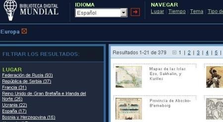
The library makes it easy to find information by region and once selected, it can be filtered by country, time period or type of content.

Here we list links to regions and total material available to this date (September  2009)
2009)
• Africa | + View All 120
• South Asia and Central Asia | + View All 65
• East Asia | + View All 99
• Europe | + See all 379
• Latin America and the Caribbean | + See all 319
• North Africa and Middle East | + See all 177
• North America | + See all 137
• Oceania Pacific | + View All 31
• Southeast Asia | + View All 49
• Antarctica | + View All 1
• World | + View All 23
A little bit from the sample (Spanish Idiom: “Para muestra, un botón”)
Interesting documents that can be viewed:
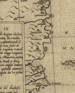
• Geographic Atlas from Antoine du Pérac Lafréry, 17 maps of Europe published in 1575
• Topographic Map Valley from Centa, north of Argentina, published in 1794.
• Photo from Mazatlan’s Carnival, Mexico 1948
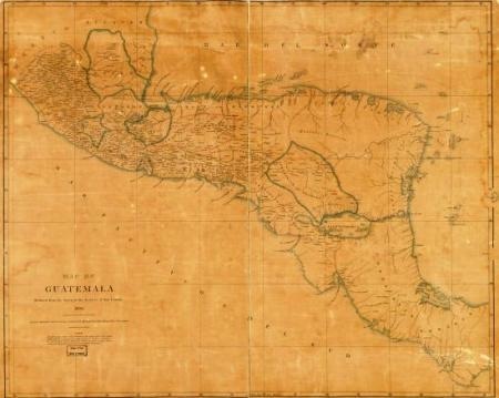
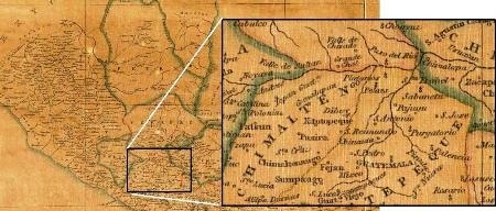
The digital files can be downloaded, but not at full resolution; furthermore, the online viewer allows a very good approach. An example is shown below, in these days of political tensions in Central America:
The map of Central America provinces, when they formed a single republic between 1823 and 1838.

Look at the detail’s level; it’s curious that this was one of the maps used with malicious intent to support England in its dispute with Guatemala in the region now known as Belize (formerly British Honduras).

The site is: World Digital Library
 Autocad Software, Bentley Microstation, Gis Google Earth, Gis System Geomate Provides Services For Complete Gis Software And Solutions, Autocad Software, Autocad Courses, Bentley Microstation, Microstation Software, Gis Google Earth, Open Source Gis And More.