A few years ago Google began mapping business; in that project Google was even paying $ 10 for every business to be georeferenced. Now they have a base that can be deployed both in Google Maps and Google Earth.
Now imagine that there is an application that, with only giving a location and a radio distance can extract for us businesses which are within the circle area and preferably by category.
Touche Google Maps Extractor does this:
Having a toy like this, I would have saved me a lot of laps on my last trip. Let’s try an example:
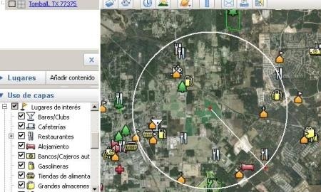
This is Tomball, Houston. I’ll try with TX 77375 postal code. If we see in Google Earth, to activate the layer of interest sights you can see the symbols of different businesses, but not all are displayed at the same elevation for space reasons, nor are all the categories there.

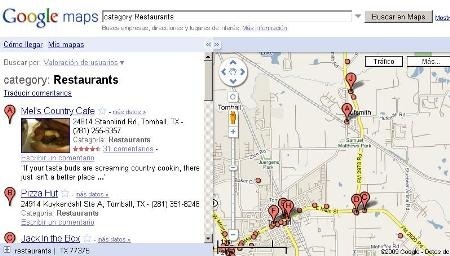
While they’re seen in Google Maps, but the left panel navigation is not functional.

Let’s see it in action
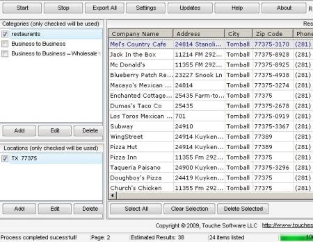
I found the application wonderful, I just added the location, the category “restaurants”, 2 miles away and in seconds the system returned me 36 results with more data than it could be asked:
Company name, telephone, zip code, website, latitude, longitude and an url for seeing the Google Maps’ display.


For geomarketing purposes it is very useful because it allows you to find strategic alliances, business competition. Additionally you can send the list to an Excel file in cvs format to make more crazy things with latitude and longitude columns.
I assume the next application version will include a viewer or the generation of a kml.
Price? It’s only $27, although it can be downloaded the trial version to ensure what you are looking for.
Here you can download Touche Google Map Extractor.
In some moment, antivirus reported me a spy robot by the time of downloading and installing the program, but it seems to be only the cookie that traces the trial version.
______________________________________________
| The Google Earth’s general categories are only 12, the ones showed in the list of the right, but in total with subcategories they are round 520.
For example, Real State contains the following sub categories: -Agents & Realtors -Apartment Buildings & Complexes -Appraisers -Commercial -Home Inspection -Property Management -Surveyors |
Main Categories
Here you can download the Excel file with all the categories and sub- categories provided by Reuben Yau. |
 Autocad Software, Bentley Microstation, Gis Google Earth, Gis System Geomate Provides Services For Complete Gis Software And Solutions, Autocad Software, Autocad Courses, Bentley Microstation, Microstation Software, Gis Google Earth, Open Source Gis And More.