 Autocad Software, Bentley Microstation, Gis Google Earth, Gis System Geomate Provides Services For Complete Gis Software And Solutions, Autocad Software, Autocad Courses, Bentley Microstation, Microstation Software, Gis Google Earth, Open Source Gis And More.
In our Geo-engineering context, is no longer novel the BIM (Building Information Modeling) term, which allows that different real life objects can be modeled, not only in its graphical representation but in their different life cycle stages. This means that a road, a bridge, a valve, a channel, a building, from its conception can have a record that identifies it, containing its design, its construction process, affecting the natural environment, operation, use, granting, maintenance, modifications, over time monetary value and even demolition.
Using the given theorists approach as a result of geosmoking this topic, the BIM route maturation is associated with the advance of the necessary inputs to its development, such as the capture equipment capabilities and (new and existing) information management, the global standards implementation, data infrastructure and the different evolutionary processes modeling associated with the management of the territory. A BIM challenge is to reach a moment which include an intrinsic relationship with the PLM (Product Lifecycle Management), where the manufacturing and services industry seeks to manage a similar cycle but with scopes that do not necessarily include the geospatial aspect.
A convergence point of these two routes (BIM + PLM) is the concept of smart cities (Smart Cities), where most big companies are putting their eyes, therefore because the urgently demand of such large cities as their irreversibility in front of the inexhaustible human ingenuity in science and applied technology to decision-making.
Below, we detail some basics aspects and progress in relation to BIM and its relationship with popularized technology tools.
The levels of the BIM
Bew and Richards theorize the BIM maturation path on four levels, including the zero level, as seen in the graph. Clarifying that this is a route from the standardization perspective, not so much of world adoption, which is left much to talk about.

BIM Level 0 (CAD).
This corresponds to the computers aided design, viewed from the primitive optic that we saw in the years 80’s. For those times, the priorities were to convert technical drawing that was already done in sets of plans into digitized layers. We remember as examples the birth of AutoCAD and Microstation in those times that, without diminishing this giant step, no more than drawings were done; their file extensions alluded it (Drawing DWG, DGN Design). Perhaps the only software that already displayed beyond was ArchiCAD who since 1987 spoke of Virtual building, with the scorn of its Hungarian origin in the cold war years. Also within this layer is included not georeferenced data management from other applications related to the projects management, examples: budgets, planning, legal management, etc.
BIM Level 1 (2D, 3D).
This happened in the past decade, on the workspace maturity that can already be called 2D. The construction in 3D space is also given at the start, although in its early stages, we can recall how tedious was to do it with AutoCAD R13 and Microstation J. There was a three-dimensional work visualization, but remained being vector consisting of arcs, nodes, faces and groupings of these elements. In AutoDesk case, versions like SoftDesk integrated concepts like surfaces from AutoCAD 2014 with which roads designs and spatial analysis were made, but everything was behind a black box that solutions as EaglePoint did more “colorful”. Microstation already included Triforma, Geopack and AutoPlant under a similar logic, with spatial connections of engineering-links type without consensus standardization.
Since this decade, although that did not even exist conception models and standardized objects, it is in fact done the somewhat forced integration with vertical solutions acquired from third parties for AEC, which includes architecture, construction, geospatial, industry, manufacturing and animation.
AutoDesk does not speak of BIM up to the Revit purchase in 2002, but the integration of solutions as Civil3D take it much longer. In Bentley case is significant the XFM (Extensible Feature Modeling) scheme entrance in Microstation 2004 and during the transition known as XM will acquire third-party platforms such as Heastad, RAM, STAAD, Optram, Speedikon, ProSteel, PlantWise, RM-LEAP Bridge and HevaComp. In 2008 Bentley launches Microstation V8i, where XFM matures to the I-model as collaboration standard.
BIM Level 2 (BIMs, 4D, 5 D)

The hardest thing at this BIM level 2 stage has been standardization; especially because private companies take an arrogant position and want to force others to use their own whims. In the case of software for geospatial field, free software has been the one who has made force for Standardization with the consensus degree that now represents the Open Geospatial Consortium OGC. But in the CAD-BIM field, there has not been OpenSource effort so that to date the only free software with potential to mature is LibreCAD, which is just in the level 1 – if it isn’t exiting the level 0. Proprietary companies have released free versions, but the standardization to the BIM has been slow, in the some voices because of the imperialist monopoly.
The British contribution is noteworthy, with their habit of making almost everything upside down have led the British Standard, such as the BS1192:2007 and BS7000:4 codes; These are so old from paper planes to BIM level 1. The BS8541:2 appears already in the digital model and in this decade appeared, the BS1192:2 and BS1192:3.
It is understandable why BentleySystems made the annual infrastructure Conference and its awards ceremony in London in the years 2013, 2014 and 2015; as well as companies acquisition with high UK customers portfolio – including I dare think about the European headquarters movement in the Netherlands to Ireland -.
Finally, always within the OGC framework it has been moving forward with several standards of consensual acceptance to BIM, especially the GML, from which are advancing examples such as InfraGML, CityGML and UrbanGML.
While many current efforts in this BIM level 2 decade attempt to reach the models life cycle management, they cannot still be considered comprehensive or standardized, as well as outstanding debts with the 4 D and 5 D including the construction schedule and dynamics estimation. Trends in the disciplines convergence are notorious both in the companies fusion/acquisition as in the holistic view by standardizing.
BIM level 3 (Integration, Life Cycle Management, 6 d)
The integration level expected in the BIM level 3, after 2020 includes somewhat utopian uniformity expectations in the standards: Common Data (IFC). Common Dictionaries (IDM) and Common Processes (IFD).
It is expected that the life cycle adaptation lead the Internet of Things ( IOT), in where only is not modeled the ground surface, but also machineries and infrastructures that are part of real estates, the objects used for transport (movable) goods for domestic consumption, natural resources, all in the life cycle that applies to the public and the private law performance of owners Planners, designers and investors.
In Bentley Systems case, I remember seeing since year 2013’s presentations in London, the integration of the two processes project cycle definition:
- PIM (Project Information Model) Breef – Concept – Definition – Design – Construction/Commission- Delivery/Closing
- AIM (Asset Information Model) Operation – Use
It is an interesting view, considering that these aspects are of the next decade, but as being developed allow to realize the standardization. Despite having many vertical solutions, CONNECT Edition services orientation creates Hub conditions within a single environment for what Microstation is the modeling tool, ProjectWise the project management tool and AssetWise the operation management tool, so that close the two important moments Opex and Capex from the BS1192:3.
It is also expected that at this stage the data are considered as an infrastructure, requiring channels to be distributed, standardization to be completely usable, and, of course, available under real time conditions with greater participation by the consumer.
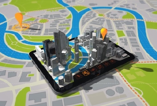
The smart cities is the lure of the BIM
 The BIM level 3 challenge is that the disciplines already converge rather than through file formats but through services from BIM-Hubs. An interesting exercise of this will be the smart cities, in which already use cases like Singapore, Copenhague, Johannesburg make interesting attempts by merging e-Government with the g-Government, if we allow ourselves to those terms. But it is also an interesting challenge, that in this BIM level 3 environment, all human activity is modelled. This implies that aspects such as finance, education, health, environment, within a cycle linked to spatial management are included. Of course, we will not see functional exercises of those in this decade, even is questionable whether they really reach to occur in the medium term, if we consider that the aspirations are to ensure improvement in the inhabitants life quality of this planet – or at least those cities – and the damages recovery to the global ecosystem – which does not depend on a few cities-.
Despite the Smart Cities are not just around the corner, is notorious what is happening with corporations who control the technology.
HEXAGON, with companies acquisition such as Leica can control the data capture in the field, with the Erdas + Intergraph acquisition can control the spatial modeling, now is recently making a suspicious approach with AutoDesk to control the design, manufacture, and animation. Without mentioning all the companies include in that emporio, pointing to the same object.
On the other hand, Bentley controls the design, operation and cycle of a wide range of construction, architecture, Civil and Industrial Engineering industry. However, Bentley does not seem to be interested in stealing space from others, and we see howit does partnership with Trimble which bought almost all competitors related with management and modeling field, SIEMENS which has a high control of the manufacturing industry and Microsoft that aims to move towards data infrastructure – so as not to get out, because in this visionary environment has been lost with its Windows+Office-
By where we see it, companies are betting to BIM for their imminent potential in the three axes that will move the Smart Cities operation: means of production, infrastructure offer and innovation to new products and services demands. Of course, there are giant monsters to line up with blocks, such as ESRI, IBM, Oracle, Amazon, Google, to mention a few of them that we know are interested in their own Smart Cities initiatives.
If we consider that Smart Cities are the next business, under a BIM + PLM integration, there cannot be a Microsoft who takes over 95% of the market. This is a much more complex model, but what we see is that companies that do not bet to that business will be outside doing CAD, Excel spreadsheets and closed CRM systems. Businesses to integrate are those that are not within the traditional life cycle of Architecture, Engineering, Construction and Operation (AECO); but in seeking the integration of other human beings activities under a geo-referenced socio-economic approach, such as manufacturing, e-Government, social services, agricultural production, and above all the energy and natural resources management.
The GIS will be integrated in BIM under the smart cities vision. They are currently almost fused in the capture and data modeling, but they have different views; for example, infrastructure modeling is not a GIS competence, but indeed it is very specialized in spatial objects analysis and modeling, projection scenarios, natural resources management and all the wide Earth Sciences. If we consider the sixth dimension (6D) in times of intelligent cities, quantify, use, recycle and generate energy will be important, it will then be necessary capabilities that now the GIS makes with many specialty. But from analyzing the ability to generate water in a basin, to know how much performance is necessary for a cubic meter of concrete, there is a tremendous gap; that will fill it as involving the operation as shared cycle of these two disciplines.
In Conclusion.
There is much more to talk about, and I hope to continue writing about this topic. But for now, the challenge for ourselves Geo-engineering professionals is to align with the irreversible and learn since the technical level, because by now it is even questionable whether the Roadmap to implement BIM can be done without dependence on the working group that he is leading. Above all, because the BIM is involved from two perspectives: one of things that must be done in the technical, academic, operational level with a view to sustainability; and the other, the Governments optics, which have expectations in too short-range, forgetting that their regulatory capacities are often extremely slow.
 Additionally, for those who are in cities that they may already think in Smart Cities, it is urgent to have a focus on citizens, rather than the technology.
:) If this scenario is true, would become reality the ahead dream in which is envolve one of my mentors, hoping to plant 3,000 hectares of mahogany forest, with a certified lifecycle associated with its growth; so that it could, at the end of the year, go to the Bank and mortgage the first plot to finance gradually the rest. In 20 years you will have a million cubic meters of an asset that can solve not only retirement, but even his country’s external debt.