Some time ago I had seen on the Google Earth’s official blog, but after that Opaco has reminded us, I took a few minutes to see it working. I mean the old maps from the Rumsey collection made on Google Maps or Google Earth.
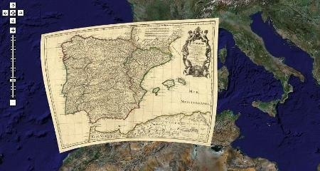
This example shows a map of the Iberian Peninsula in 1710, Spain divided by Castilla and Aragon. Portugal also appears.
The David Rumsey collection began 20 years ago, with primary focus on mapping the Americas of the 18th and 19th centuries (I will use these nomenclature because Roman numerals get me gray hair when I read) but it also contains world maps of Asia, Africa, Europe and Oceania. The collection to date amount near to 150,000 maps includes atlas, areas, school maps, books, charts and a variety of maps including Pocket, wall, children’s maps and other manually elaborated.
The scanning began about 1997. Thus it was possible to have this kind of valuable documents with high resolution, because if you remember, maps were content in great detail, now everything is in the database and for different purposes such results are represented graphically.
Of course, one of the goals was always to serve on the web and what better than to see them in the world popular mapping services, such as Google Maps and Google Earth, toys that changed the way we see the world.
In this map you can see the different rate of existing maps, and in the case of world maps there are in the middle of the Atlantic Ocean. By bringing the mouse close it shows the year of the product.
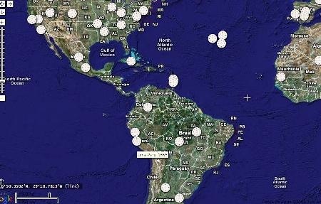
Once clicked the icon, you can see the overview map, a link to see all the concerned information on both the original and the digitized map and another link to view deployed, with which it activates some sticks where you can control the transparency. Look eastern Brazil, 1842.
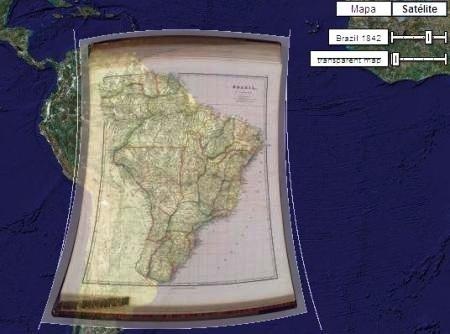
To view them in Google Earth just have to download this kmz that binds and allows viewing.
See this map of Colombia in 1840 while still including Ecuador, Venezuela and parts of Peru.
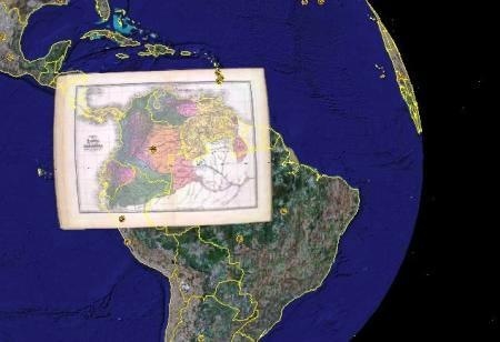
And what to say from this of East Argentina, 1867, this map shows the native American tribes in the middle of the 19th century
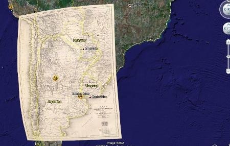
It really is a valuable contribution to the dissemination of that mapping collection. Here you can view the entire collection
And this is a list of some of the most significant maps
 Autocad Software, Bentley Microstation, Gis Google Earth, Gis System Geomate Provides Services For Complete Gis Software And Solutions, Autocad Software, Autocad Courses, Bentley Microstation, Microstation Software, Gis Google Earth, Open Source Gis And More.