Spatial patterns incidence detection and trends in crime is an interest topic of any State or local government.
CAST is a free software’s name, its initials are Crime Analytics for Space – Time, which was released in 2013 as an open source solution for actuarial analysis, spatial patterns and trends algorithms in the criminal statistics management.
CAST is a client application developed on Python and C++ that runs on Windows, Mac and Linux, created by none other than the GeoDA Center, which has developed several applications of computational and spatial analysis. This Centre has a laboratory which was founded by the Director of the school of geographical sciences and urban planning at the University of Illinois.
In this case, CAST was promoted through an award from the National Institute of Justice and the Justice programs Office of the United States Justice Department. The methodology for the algorithms’ development was worked with Arizona State University.
The application supports SHP files, the incidents are usually shown as points and  through spatial analysis generates trends from dates, for which it requires polygons maps like neighborhoods or blocks.
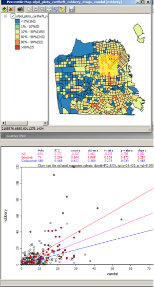
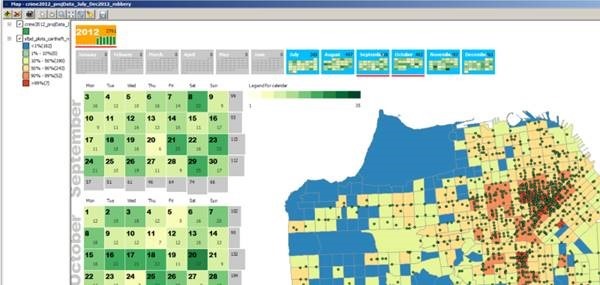
Apart from charts it can be created theme maps from statistical deviations and also heat and maps calendar.
Perhaps the most attractive in this application comes with previously defined specialized functions for trend analysis purpose and reports based on the matter. For example, a trend can be normalized across the population data to represent the number of violent incidents in segments, like the case of deaths’ number per 100,000 population. Then it allows temporary analysis, to determine through graphic the growth, decrease, and specific case studies in both tabular level as spatial. Similarly, the calendar personalization can make analysis between specific days, as, for example, incidents on holidays or weekends.
It’s only matter to play with the tool, as you can even generate animated maps on a temporal scale, with which it is possible to determine where criminality stain will spread if the trends hold. Of course, it must be interesting to apply new data from taken security measures, to see the impact it has. This is something very useful in urban areas which its actual influence context suffer organized crime and gangs, that can be surely detected as interconnected clusters. And as the system is made for that purpose, fits to models of security management and violence prevention, handling quadrants, sectors or districts.
In conclusion, it’s a valuable application. One more under the open source model, for which we wish broadcasting sponsors, if we consider what Governments invest in security for not so specialized capabilities.
CAST can be downloaded from this link and the user’s manual too.
 Autocad Software, Bentley Microstation, Gis Google Earth, Gis System Geomate Provides Services For Complete Gis Software And Solutions, Autocad Software, Autocad Courses, Bentley Microstation, Microstation Software, Gis Google Earth, Open Source Gis And More.

